
”Telemonitoring the Danube”
Beia Consult International has installed and is further developing for the National Administration “Romanian Waters” (ANAR) an automatic system able to continuously monitor the level and water temperature along the Danube and some of its tributary rivers.
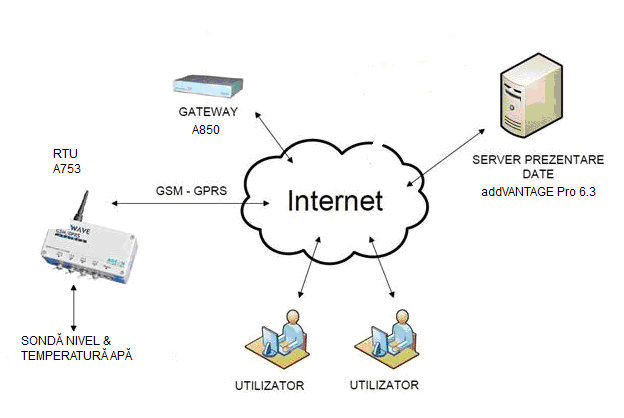
The central elements of this telemonitoring system can be seen in the figure above.
– Data concentrator (Gateway) performs communication with the remote telemetry units (RTUs) and also allows the configuration and management of all RTUs and sensors.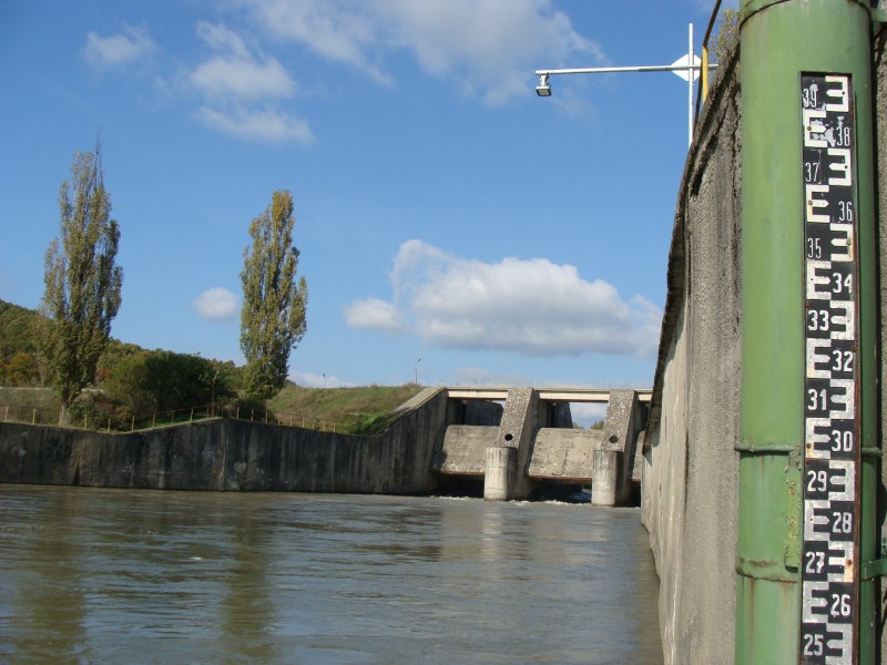
– Data presentation server is hosted on a computer with strong server features (such as safe unattended running 24/24 and 7/7) and based on the software package Adcon addVANTAGE Pro 6.4. It is mainly focused on the presentation of data in various formats (tables and diagrams, for instance), which are entirely at the free choice of users. Changing data presentation formats is however allowed to those users only who have the right to make such changes; a very sophisticated rights hierarchy system does exist in the addVANTAGE Pro 6.4 server. Data processed by the presentation server are also continuously and automatically exported towards ANAR’s central data and dispatcher systems.

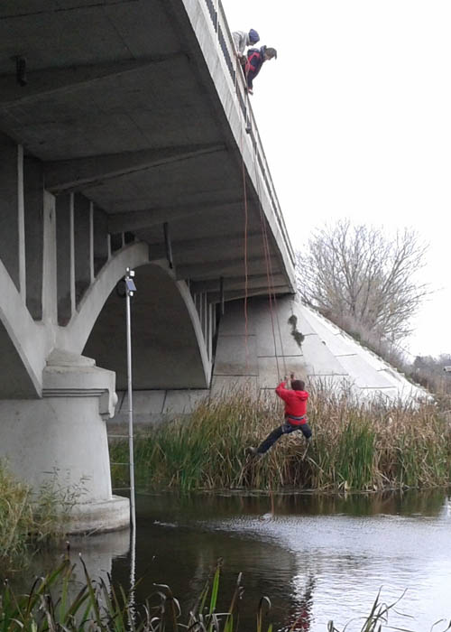
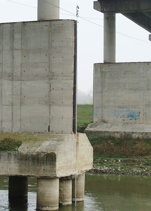
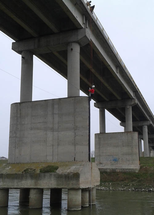
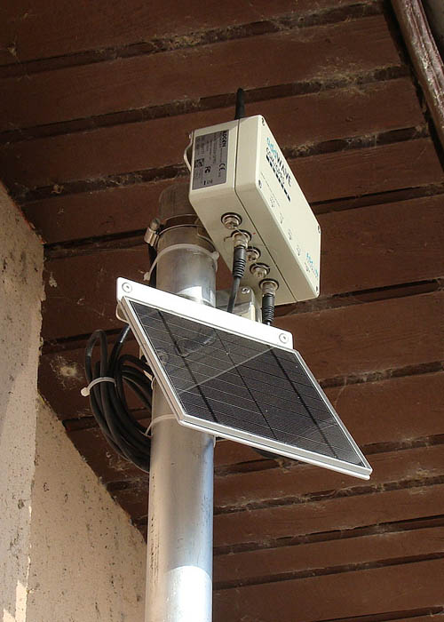
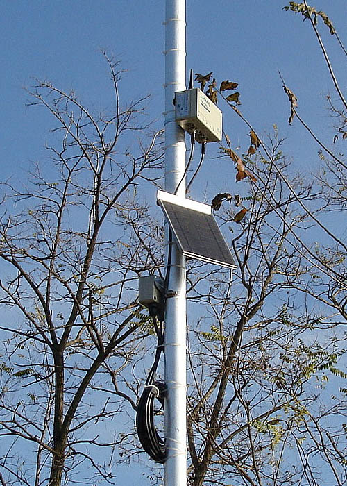
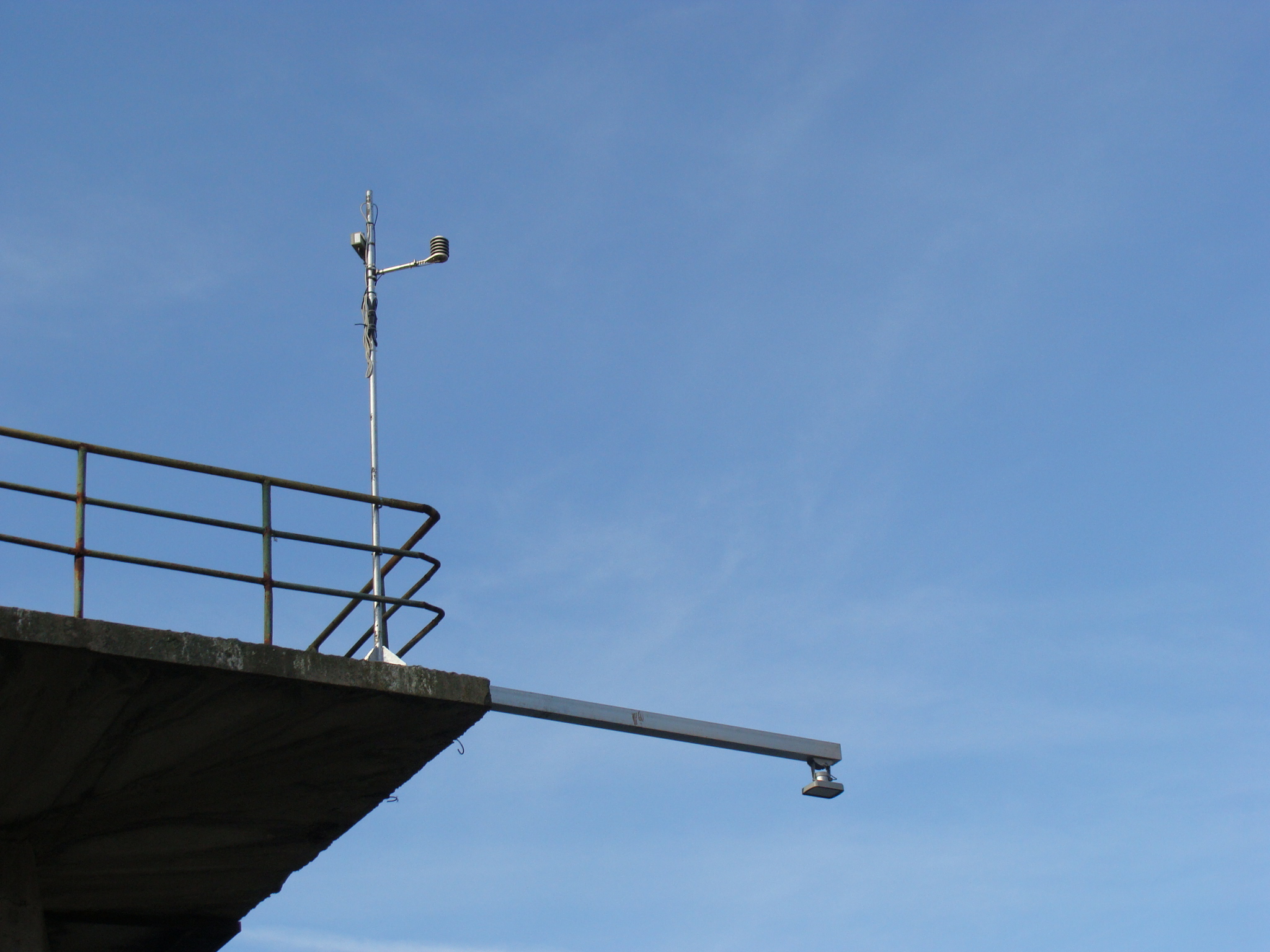
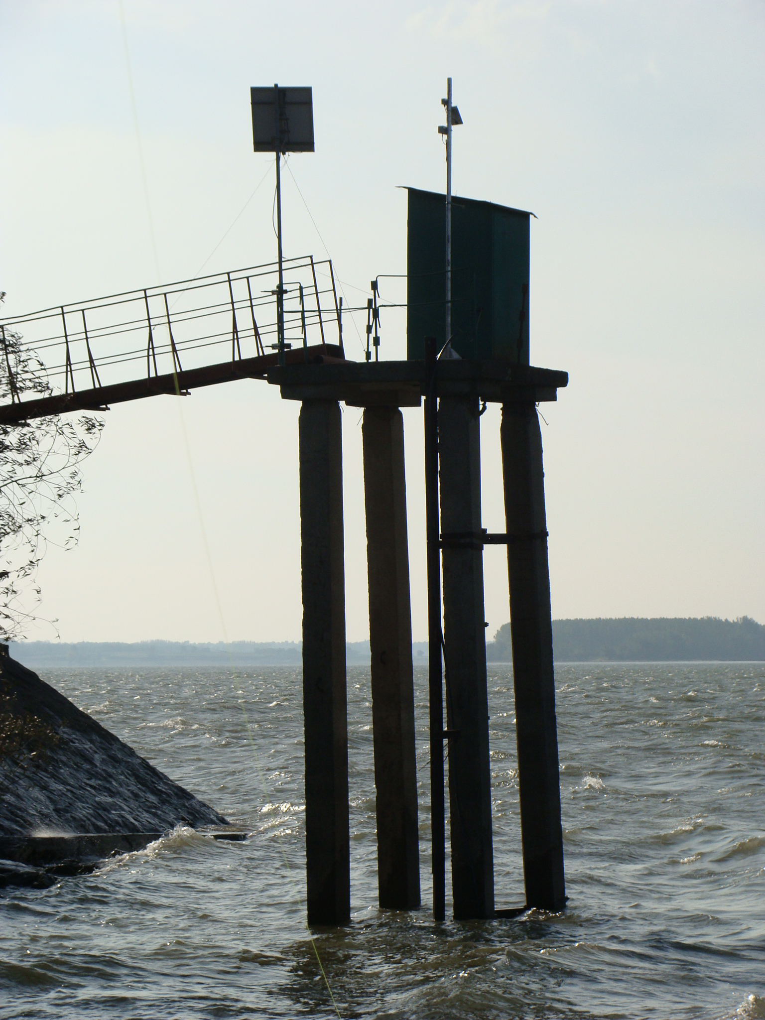
At each monitoring location, a telemonitoring installation was built-up. It mainly consists of an Adcon A753 GPRS remote telemetry unit (RTU), always mounted on an aluminium mast, and a water level sensor. At some of the installations, the water level sensor is a pressure probe, immersed in water through a stably-mounted aluminium & plastic pipe. The cable going through the pipe to the pressure probe always contains an air tube ensuring atmospheric pressure compensation. At other installations, a radar water level sensor hanging above water surface was preferred (see photos above). The pressure sensor immersed in water offers the advantage of always being accompanied by a water temperature sensor. The radar sensor has, in turn, the advantage of being totally immune to problems like being clogged by dirt, sand, ice and other such things.
A solar panel is powering the RTU and sensors at all telemonitoring installations, while a combo sensor for air temperature and relative humidity can be found at the recently installed ones.
All sensors attached to a certain RTU are powered and read during short periodic time intervals. At every 15 minutes, the RTU computes from periodic measurement results an average value. At every hour, the 4 average values for every of the monitored parameters is sent by the RTU to the A850 central gateway.
Virtually all communication within the Danube telemonitoring system is performed via the Internet, which brings to the system important advantages in what concerns investment and operation. Users, for instance, can have access to the data prepared by the presentation server anytime and anywhere, from any terminal able to access the Internet (PC, I-pad, smartphone etc.).

Telemonitoring installations like the one above-described are installed along the Danube and some of its tributaries in the places indicated on the map.
At the end of year 2015, the number of telemonitoring installations cut-in service by BEIA for the National Administration “Romanian Waters” amounts to 21. As indicated on the map above, the most Western can be found at Lugoj (on the Timis river), while the most Eastern finds itself on the Danube’s Chilia arm, not far from the Black Sea.
Level and water temperature sensors are powered for short lapses of time and read by the RTU at every 3 minutes. At every 15 minutes, the RTU calculates an average from the 5 values measured during said interval. At every hour, the RTU transmits to the gateway and furthermore to the data Presentation server (PS) the 4 average values computed for each of the parameters measured (water level, water temperature, air humidity inside the RTU case as well as a lot of RTU-specific parameters, like battery voltage, internal temperature, transmission delays and error rates etc.).
The value that the system primarily delivers as water level at each location is the height of water above the level measuring sensor. The Presentation server performs the necessary corrections in order to provide the ANAR data systems with the values officially recognised as water levels along the Danube and tributary rivers.
Pictures taken at some of the monitored locations


The primary value that the pressure probe type water level sensor delivers is the height of water column above the sensor. When the water level sensor is radar type, the primary value is the distance between radar and water surface. In both cases, the system allows alignment calculations, so that what is being finally delivered is the water level officially recognised by the “Romanian Waters” National Administration.
The addVANTAGE Pro 6.4 data presentation server basically offers processed data such as diagrams, tables and even split-screens with diagrams and also data or events in table format. There are multiple ways to visualise diagram-form data over various time intervals in the past (from one day up to one year or more), with the possibility to read the punctual data at a chosen date and time. It is also possible to highlight a certain time interval over which the presentation server is able to calculate and clearly show the average, sum, min and max values.
Examples of data diagrams (Click on chart to enlarge)
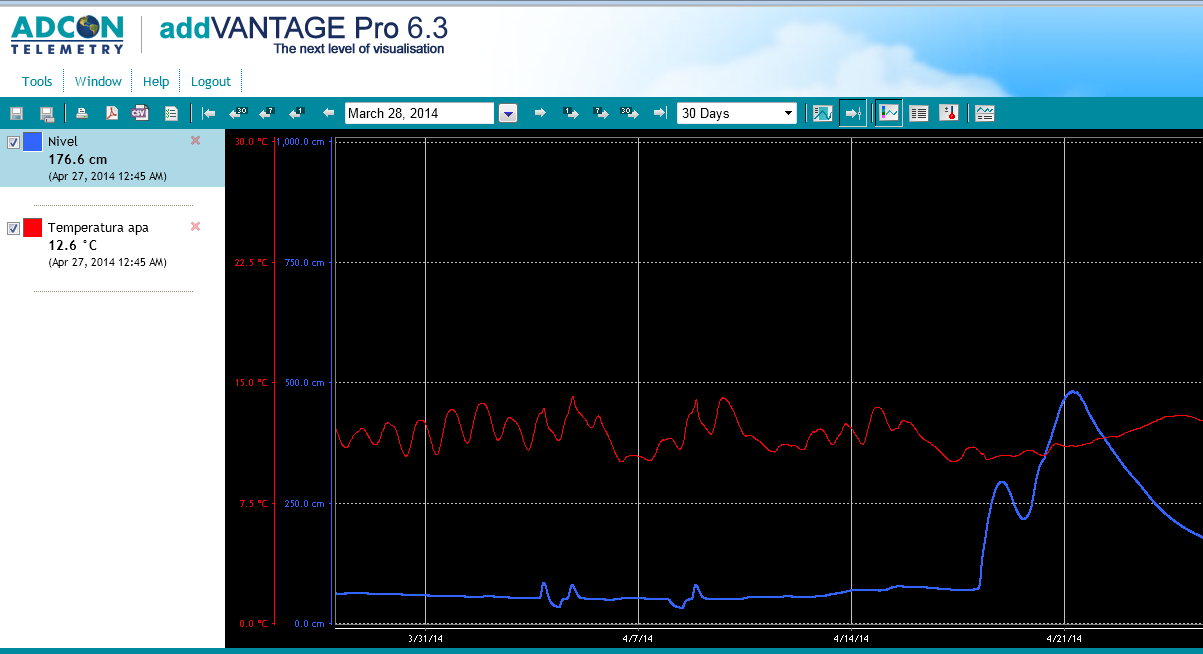
Evolution of level and water temperature on the Vedea river at Conțești, during April 2014

Evolution of level and water temperature on the Danube at Calafat, during May 2014